Bieszczady trails: 25 routes, measured rather than copied
Every number on this page we worked out ourselves — from the trail geometry in OpenStreetMap and a digital elevation model, or from our own GPS tracks. None of it is copied from a guidebook. Total climb is computed with a threshold that filters barometer noise; naive summing roughly doubles the figure and makes every route look harder than it is.
The classics, with real numbers
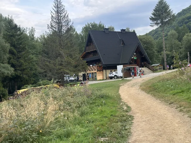
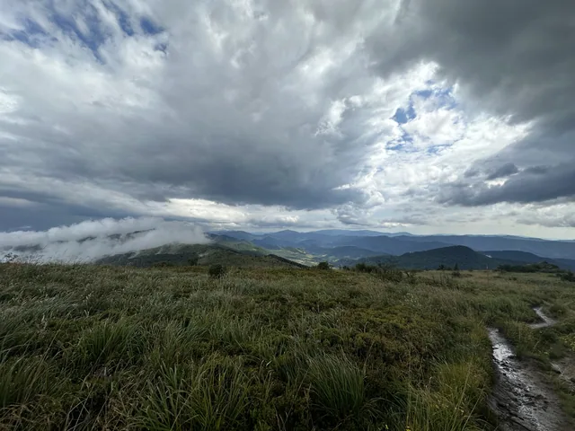
Połonina Wetlińska is the mountain most visitors come for — a long open ridge above the treeline with a mountain hut, Chatka Puchatka, at 1228 m. There are three ways up and they differ more than people expect.
- From Przełęcz Wyżna · 2.4 km, 340 m of climb, about 1 hour — the shortest way up, surfaced since 2023 and walkable in almost any conditions, including winter
- From Górna Wetlinka · 2.9 km, 291 m — a black-marked path through forest and along streams; parking is cheaper here than at the pass
- From Wetlina · 10.3 km, 591 m, about 3 hours — a full day out; almost all the climbing is in the first section, then a long, nearly level ridge
- Połonina Caryńska · 8.5 km, 568 m — the highest of our measured routes at 1275 m
- Bukowe Berdo from Muczne · 3.1 km, 419 m — the steepest we measured, over 13% average gradient
- Around Tarnica · 18.6 km, 783 m — Poland's highest peak outside the Tatras
Straight from the door
Four routes start in Bukowiec, where the cabins are. Korbania is the one we send people on first: a 10.4 km loop with 454 m of climb, roughly 2 hours 45 minutes, ending at an 884 m summit with a viewing tower and a shelter with a fire pit. A shorter approach from the car park at the end of the village is about 6 km with 333 m of climb.
A second path leaves from the same spot and turns the other way in the forest, running over the hills towards Terka. It is poorly marked and leads to no summit — worth knowing so you do not take it by mistake on your first day.
What actually decides how long it takes
Not fitness. The number of stops. We can show it: our walk up Korbania with a child and a dog took 1 hour 58 minutes moving and 2 hours 56 minutes door to door — nearly an hour standing still, and that was a good day, not a wasted one.
So the times on this page are for a steady walk with pauses for the view, not for a record attempt. For comparison, the hardest thing we have done here — Wetlina over the ridges to Przełęcz Wyżniańska, 15.9 km with 1224 m of climb — takes about six and a half hours at walking pace.
Practical things nobody mentions
Most routes end somewhere other than where they start. In season, minibuses run between the main car parks — Smerek, Wetlina, Brzegi Górne and the two passes — for 15–25 zł. There is no timetable: a minibus usually waits at the bottom of the trail and leaves once a few passengers have gathered. Hitchhiking works here too.
Car parks below the ridges are paid, several tens of złoty per day at Wetlina, Przełęcz Wyżna and Brzegi Górne.
Dogs are banned on most national park trails. The routes from our door are in a landscape park, where they are not.
There is mobile coverage on the ridges — a mast on Połonina Wetlińska sees to that — but none in the valleys. Near Tarnica your phone may switch to a Ukrainian network; Ukraine is outside the EU, so roaming is not at domestic rates. Turn data roaming off before you go into the border range.
GPX files for every route, together with elevation profiles and maps, are on the Polish trails page — the files and the numbers are the same, only the descriptions are in Polish.
Every walking route we measured
Times are moving time. A dash under the highest point means we recorded that route from a GPS track and never noted the summit altitude — we would rather leave it blank than estimate it. The four cycling loops are not listed here: they run 50–91 km with 712–1349 m of climb.
| Route | km | Climb (m) | Time | Highest point (m) |
|---|---|---|---|---|
| Łopienka from the Polanki car park | 2.4 | +29 | 30 min | 552 |
| Połonina Wetlińska from Przełęcz Wyżna | 2.4 | +340 | 1 h | 1218 |
| Połonina Wetlińska from Górna Wetlinka | 2.9 | +291 | 1 h | 994 |
| Bukowe Berdo from Muczne | 3.1 | +419 | 1 h 15 min | 1142 |
| Krywe nad Sanem — to the church ruins | 4.3 | +182 | 1 h 26 min | — |
| Sine Wiry nature trail | 4.9 | +152 | 1 h 15 min | 561 |
| Korbania from the Bukowiec car park | 5.2 | +333 | 1 h 58 min | — |
| Chatka Puchatka from Brzegi Górne | 6.0 | +492 | 2 h 4 min | — |
| Mała Rawka from Przełęcz Wyżniańska | 6.2 | +414 | 2 h 22 min | — |
| Smerek from Przełęcz Orłowicza | 7.9 | +431 | 2 h 56 min | — |
| Sine Wiry to Kalnica | 8.3 | +129 | 2 h | 612 |
| Połonina Caryńska nature trail | 8.5 | +568 | 2 h 45 min | 1275 |
| Korbania in winter — loop from the cabins | 8.6 | +414 | 2 h 4 min | — |
| Terka loop — run from the cabins | 10.1 | +337 | 1 h 34 min | — |
| Połonina Wetlińska from Wetlina | 10.3 | +591 | 3 h | 1227 |
| Korbania nature-trail loop | 10.4 | +454 | 2 h 45 min | 884 |
| Bukowiec to Łopienka over Korbania | 10.8 | +505 | 3 h | 884 |
| Dwernik-Kamień from Nasiczne | 12.7 | +555 | 3 h 6 min | — |
| Wetlina to Osadzki Wierch | 13.7 | +680 | 2 h 42 min | — |
| Wetlina to Przełęcz Wyżniańska | 15.9 | +1224 | 3 h 8 min | — |
| Around Tarnica | 18.6 | +783 | 3 h 50 min | — |
Questions we get asked
Which is the easiest walk onto a Bieszczady ridge?
From Przełęcz Wyżna up to Chatka Puchatka on Połonina Wetlińska: 2.4 km and 340 m of climb, about an hour. The path was surfaced in 2023 and is used all year, so it holds up in winter better than the alternatives.
Can I hike in the Bieszczady with small children?
Yes. From about three years old children walk most of these routes themselves — it is like a forest walk with adventures, only uphill. The two flattest routes, Sine Wiry (4.9 km, 152 m) and Łopienka (2.4 km, 29 m), are passable with a pushchair. Below three, a carrier.
Are the Bieszczady mountains hard to hike?
Less than their reputation suggests. The climbs are long rather than steep, and almost everyone without health problems can manage them at a slow pace with plenty of stops. The steepest route we measured, Bukowe Berdo from Muczne, gains 419 m over 3.1 km.
How do I get back to my car after a one-way hike?
In season, minibuses run between the main car parks for 15–25 zł per person — Smerek, Wetlina, Brzegi Górne, Przełęcz Wyżna and Przełęcz Wyżniańska, sometimes as far as Tarnica. They have no timetable; one usually waits at the bottom of the trail and leaves when a few passengers have gathered.
Booking
How to book with us
The booking form, the confirmation emails and the text messages are in Polish only — we would rather say so than hand you a half-translated checkout. Write to us in English instead and we will handle the reservation by email: photos, dates, price and the bank details for the deposit.